
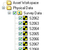
Survey Data
Survey Data are the Easting, Northing and Elevation coordinate information of the targets placed in the site work area. These coordinate data are collected in the field using a highly accurate theodolite. Survey data are managed by the Physical Data Manager and can be imported into or exported out of the asset database.
|
|
Survey points in the Asset Explorer |
Survey points in the Asset Window |
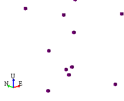
Each survey point is represented as a cube in the Asset Window. The size of the cube can be configured through user Options. All points use the same setting. The Survey Point properties dialog can be used to control the appearance of survey points.
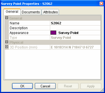
General
- The Name and Description fields provide information about the survey point. Any changes to the asset's name will be automatically reflected in the Asset Explorer.
- The Appearance field controls the color of the survey point marker. The list is populated from entries made using the Appearance Manager. Select "Inherit from Parent" from the drop-down list, if you would like the marker to inherit its appearance from its parent asset. If the marker should have its own appearance, select the appropriate appearance from the drop-down list.
- The Type field may not be edited and will always be set to survey point.
Physical
- The 3D Position is the East, North, and Elevation coordinate value of the survey point.