
Laser Scan Regions
Laser scan regions are "cloud of points" which contain points from one or more laser scans. These regions can be used for easier asset modeling and to eliminate redundancy in the point clouds. These regions are managed indirectly through Registration Areas, and are defined spatially parallel to each of the three axes (east, north, up). Laser Scan Regions are constrained by the properties of the Region Grid, and the volumes of the Registration Areas. A point in 3D space will not belong to more than one Laser Scan Region. Furthermore, a Laser Scan Region can belong to one or more Registration Areas. For display, laser scan regions are treated like laser scans.
Laser scan regions are stored in the asset database as objects. The point cloud data resides in external PCI files that are referenced by the asset database. In order to create Laser Scan Regions, a Registration Area must be created, and synchronized.
|
|
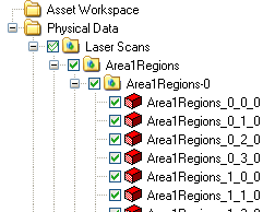
Laser scan regions in the Asset Explorer |
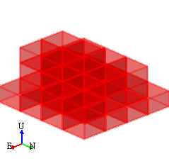
Laser scan markers in the Asset Window |
|
|
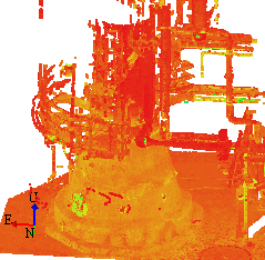
Laser scan regions displayed as points in color scale |
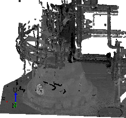
Laser scan regions displayed as points in Grey scale |
|
If you upgraded your database from RealityLINx 5.3 you will need to recreate your regions from the old file format by defining Registration Area(s). |

See also
Laser Scan Region Display Styles